Republic of Azerbaijan and the Province of Azerbaijan in Iran
Here are various internationally well-known historic maps of the region of the South Caucasus, showing the countries which existed in that geographical region, over the centuries.
Through a series of various Islamic and Western maps the establishment of Azerbaijan at the north of the Arax-Aras River is clarified.
R. Galichian
© 2018
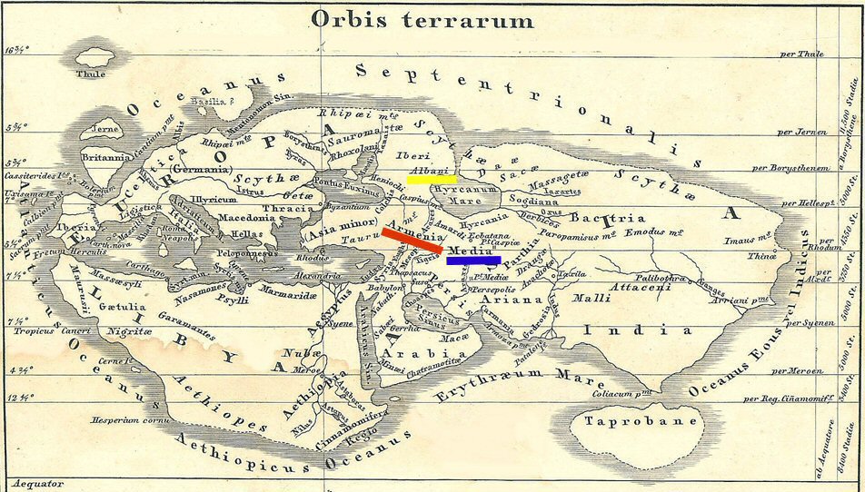
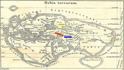
Fig. 01 – The World according to Eratosthenes, 3rd century BCE.
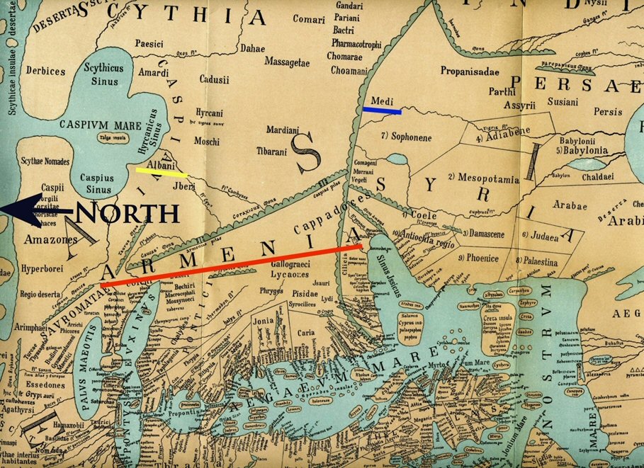
Fig.02 – Detail from the World Map of Pomponius Mela, ca. 30 CE.
Reconstructed by Konrad Mueller
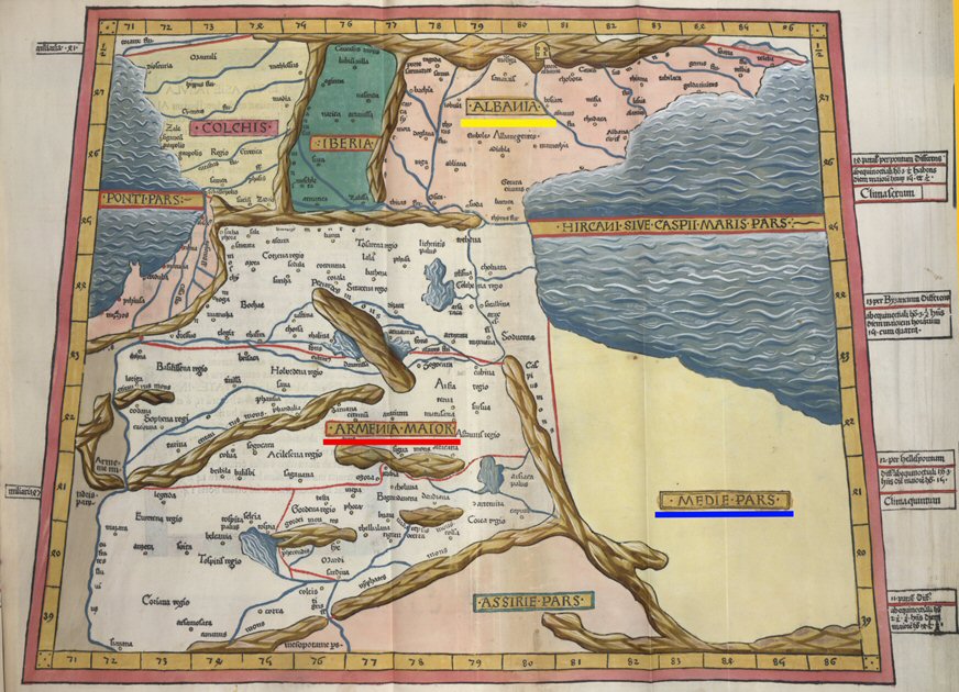
Fig.03 – South Caucasus in Ptolemy’s “Geographia”, 2nd c. Showing Armenia, Albania , Media etc.
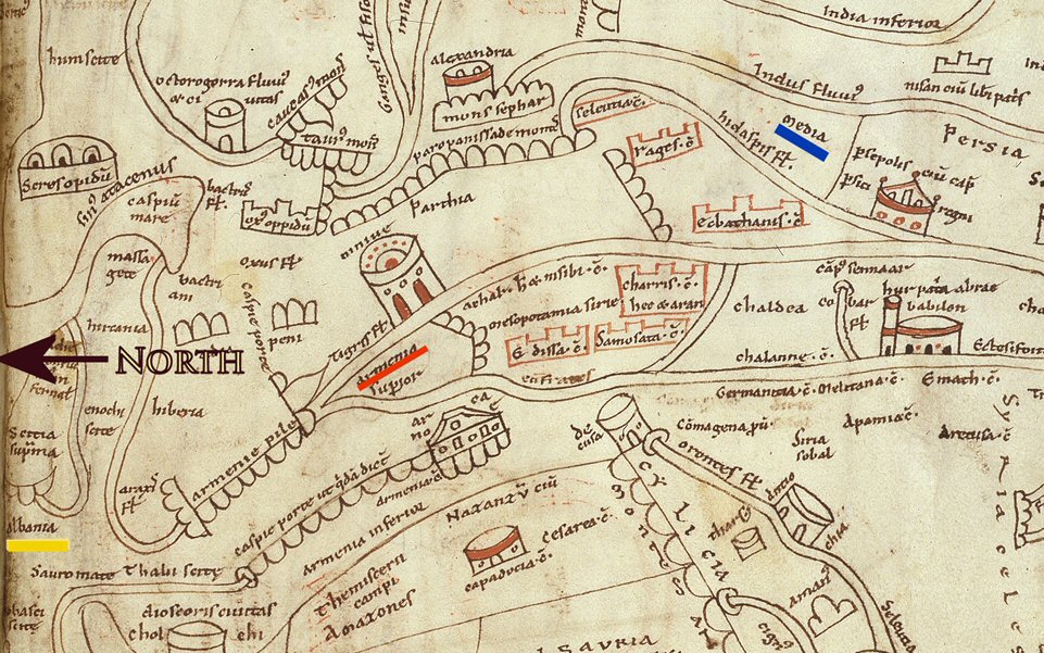
Fig. 04 – St Jerome’s map of the Middle East. 420 CE. Showing Albania, Armenia and Media.
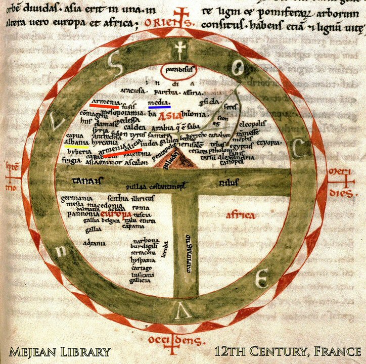
Fig. 05 – World Map form Mejean, 12th c. Sowing Armenia, Cilician Armenia,
Media and Albania. There is no Azerbaijan.
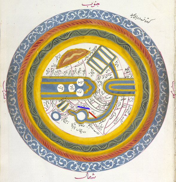
Fig. 06 – Istakhri’s World Map, 10th c., showing Armenia and Iranian province of Azerbaijan.
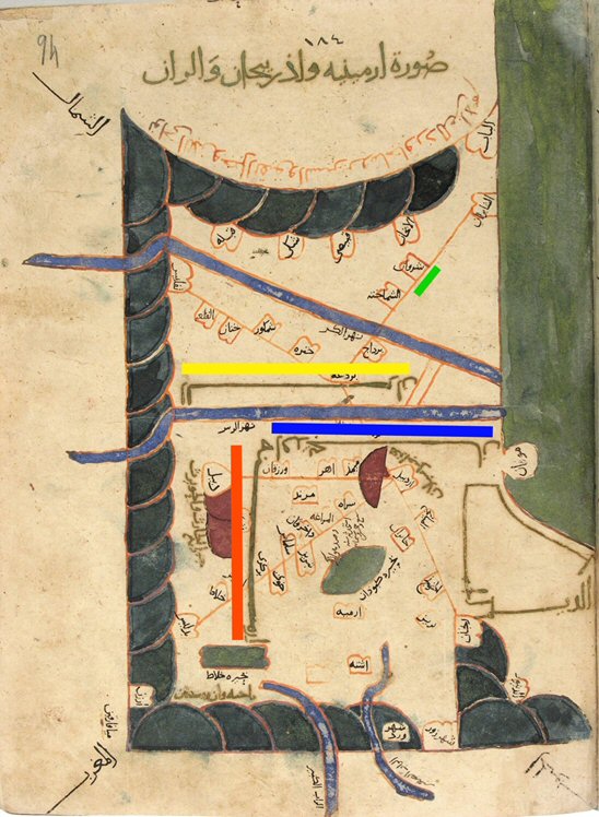
Fig. 07 – Iranian geographer al-Istakhri’s map of the South Caucasus, 10th c. The regions includes three countries of Aran [Caucasian Albania] – underlined in yellow, Armenia – underlined in red and Azerbaijan – underlined in blue, as an Iranian province, south of Arax River.
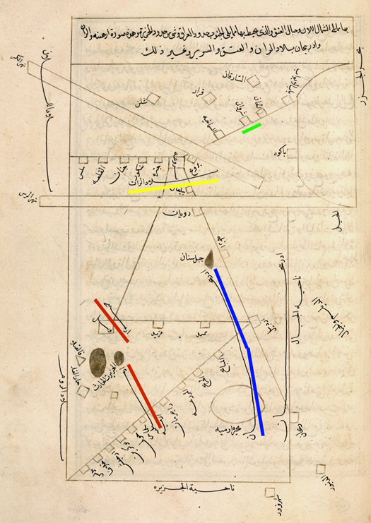
Fig. 08 – Al-Istakhri. The “Map of Armenia undelined in rad, Aran – underlined in yellow and Azerbaijan” – underlined in blue, from the book “Masalik va Mamalik”, 10th century CE.
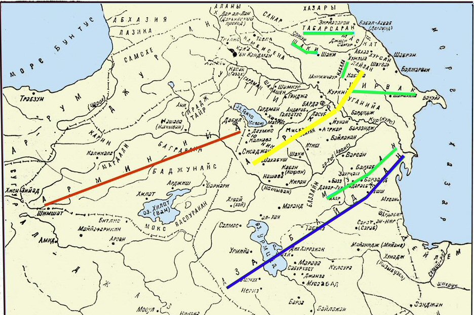
Fig. 09 – Map of the Medieval South Caucasus according to Ibn-Khurdadbeh, 864 CE, printed in Baku, 1986, showing Azerbaijan (Iranian province, south of the Arax River), Armenia. Moghan with Shirwan, Tabasaran, Kabala and Shaki are all in Aran, located north of the Arax.
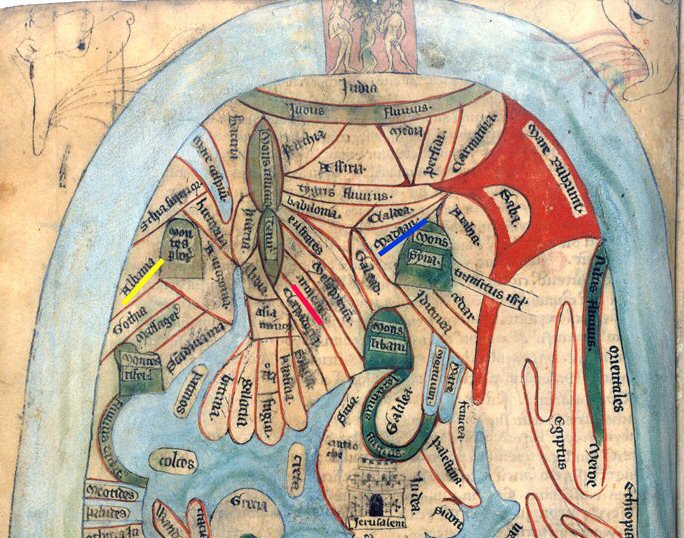
Fig. 10 – Map of the Eastern World from Ranulf Higden’s “Polychronikon”, ca. 1340. The map shows Armenia, Albania and Madian [Media, as province of old Iran]. No Azerbaijan is shown.
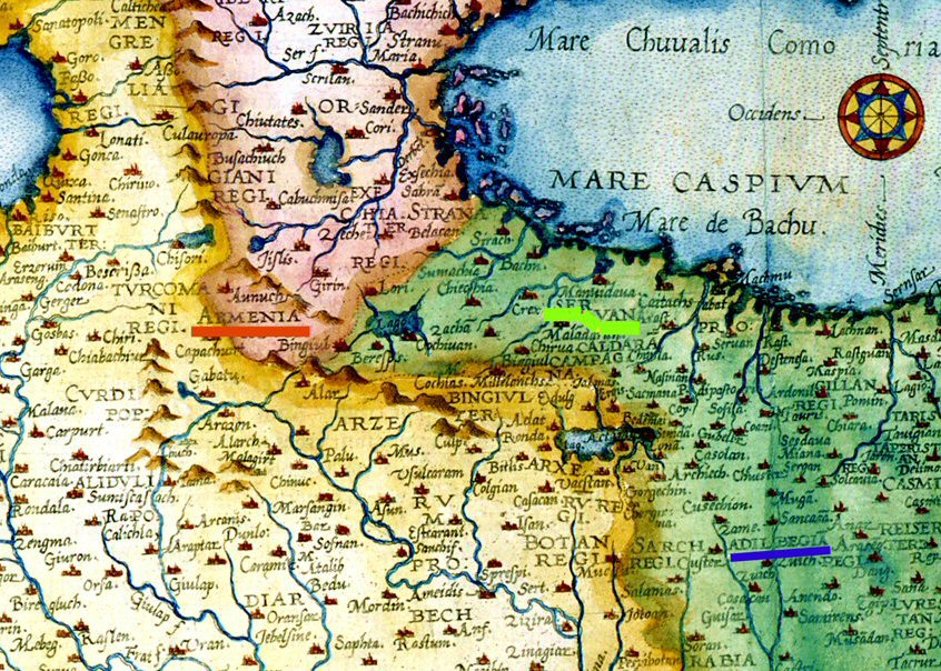
Fig. 11 – Detail from De Jode’s “Map of Persia”, 1578. “Adilbegan” is well inside Iranian territory.
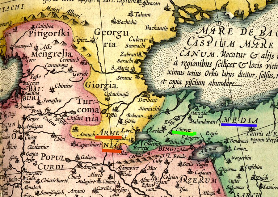
Fig. 12 – Detail from Mercator’s “Map of Asia, 1619”. Media, underlined in blue, is the Iranian province, later renamed AtropathenAzerbaijan.
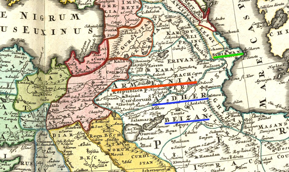
Fig. 13 – Detail from Johann Baptist Homann’s “Map of the Turkish Empire”, 1737. Azerbaijan is shown as an Iranian province.
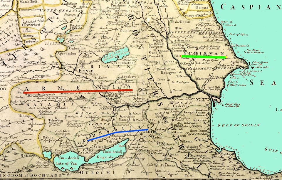
Fig. 14 – Detail from John Senex’s “Map of the Caspian Sea and the Adjacent Countries”, 1742. The region presently occupied by the Re[ublic of Azerbaijan is named Shirvan and consists of some Islamic Khanates or Principalities.
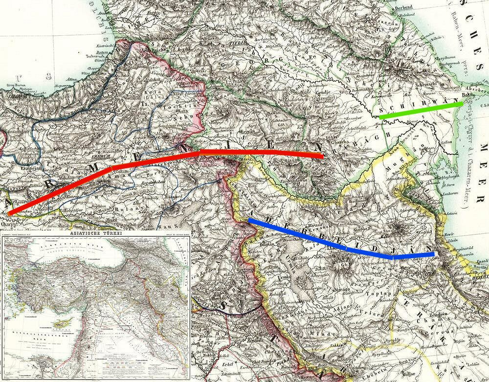
Fig 15 – Kieperts Map of the Ottoman Empire, Here Armenia is clearly shown, with Azerbaijan as the Iranian province south of the Arax.
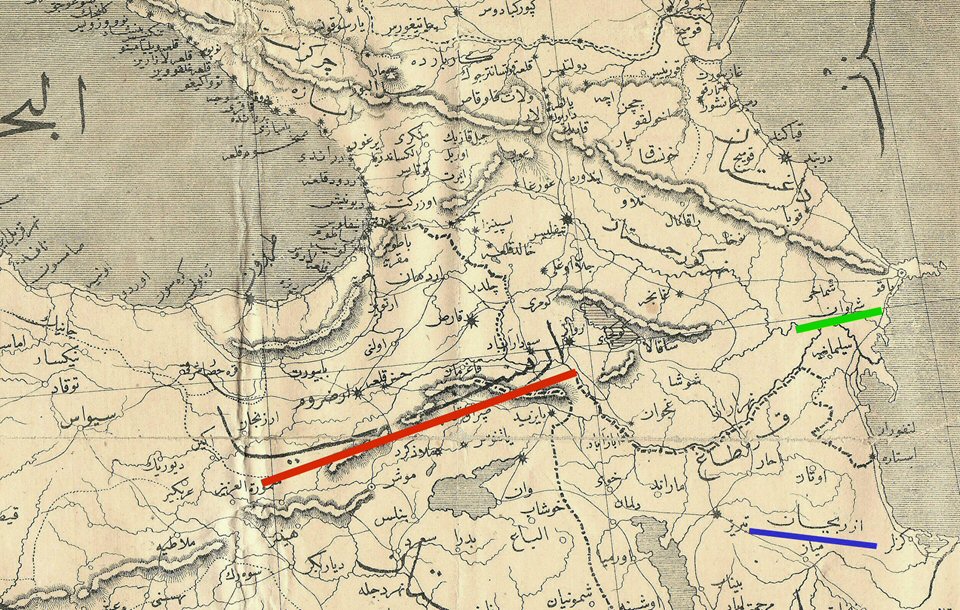
Fig. 16 – Turkish “War Map” of 1877, showing the Eastern part of Turkey,
Russian Trans-Caucasus and Northwest Iran – where the Province of Azerbaijan is placed.
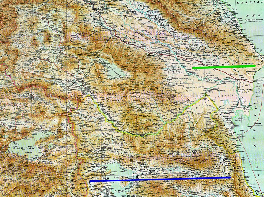
Fig. 17 – South Caucasus from Lynch-Oswald’s map of Armenia, 1901. Azerbaijan is located south of the Arax Rive, in Iran.
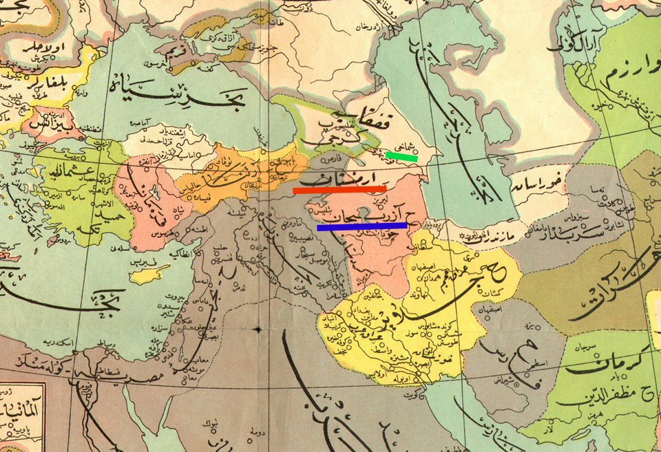
Fig. 18 – Ottoman map of the Middle East, ca. 1910, where Azerbaijan is shown as part of Iran.
North of the Arax river the map shows the Russian province of Shamachi.
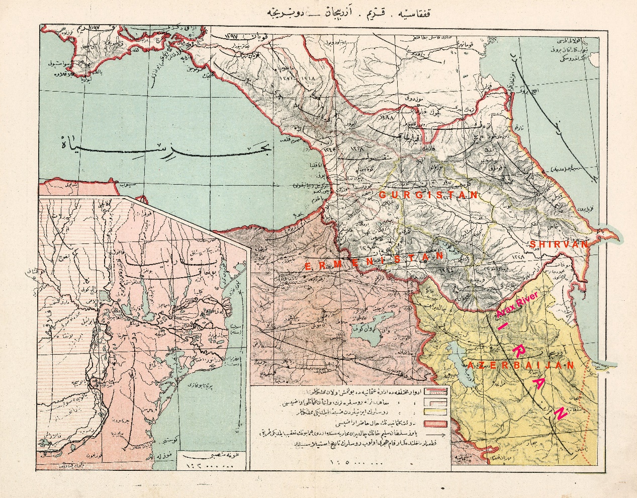
Fig. 19 – Ottoman map entitled Map of the Old Caucasus, Azerbaijan and Bessarabia,
Azerbaijan is located in Iran and the region of present-day Azerbaijan is named Shirvan. Armenia is indicated as the region of the present-day republic as well as part of the Historic Armenia, 1913.